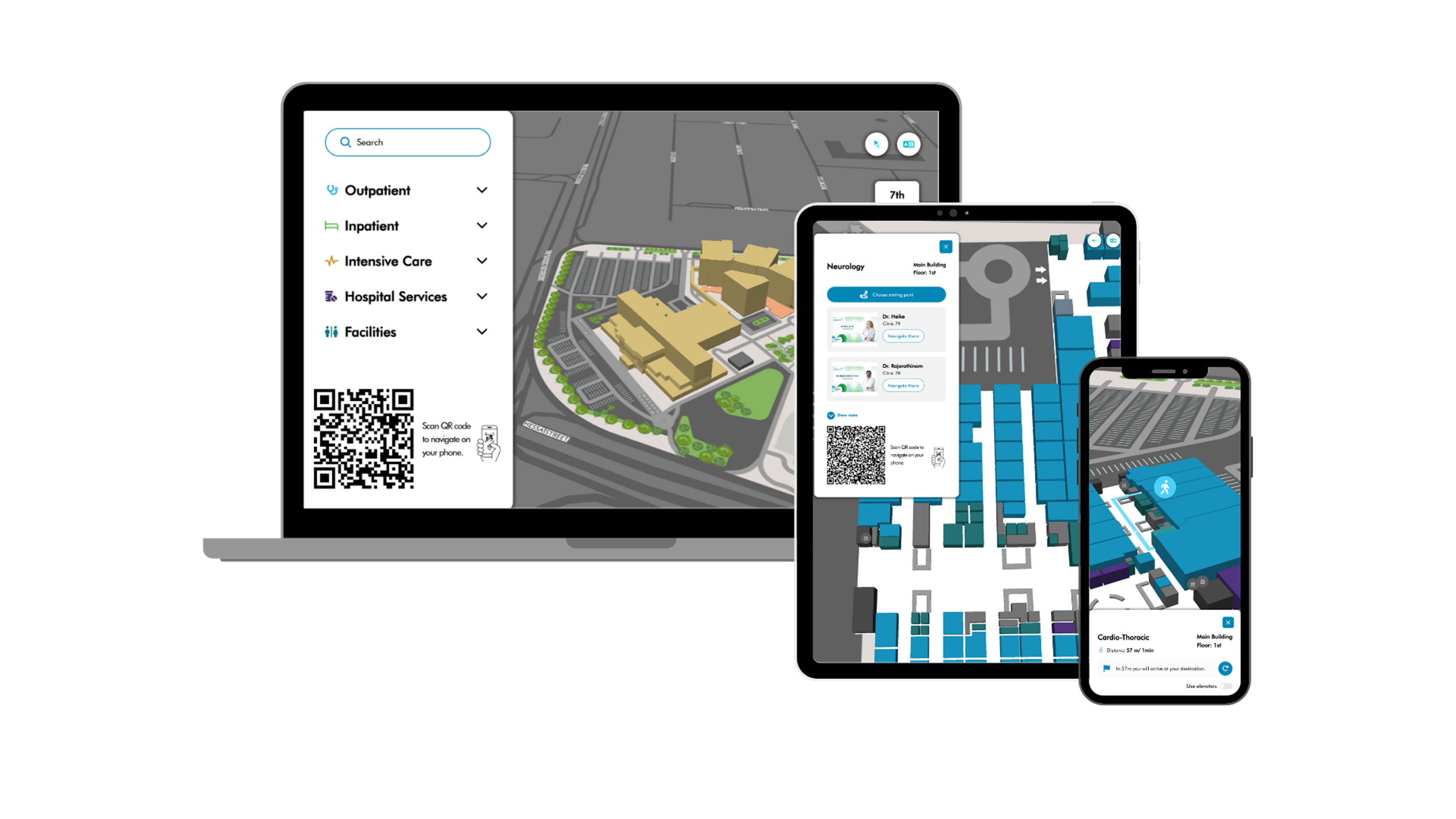


Guide your visitors across your venue indoors and outdoors
Proximi.io digital wayfinding is the most flexible solution for your venue’s mapping needs. It is a browser-based solution, which can be accessed easily through a link, QR-code or even through a touch-screen kiosk. With the Proximi.io libraries, the map can be also integrated into your website or mobile application.
With the digital map, a user can grasp all the things on offer at your venue, and how to access different locations. The wayfinding can be tailored for both visitor and staff needs.
How our customers around the world are using Proximi.io wayfinding:
- Maria 01 office hub
- Satasairaala hospital
- Dyreparken zoo
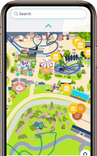
- Moomin World theme park
Intelligent routing algorithm
Proximi.io wayfinding algorithm calculates you the optimal route
- across multiple floors and buildings
- with accessibility limitations, including ability to avoid revolving doors, staircases and inaccessible paths
- indoors-to-outdoors, with a possibility to connect to city-level routing logic through Open Street Map street network
- through the shortest path in open areas

Wayfinding built for interactivity and integrations
We have built the whole Proximi.io platform API-first. Thus, you can easily import data from 3rd party libraries. Our library is based on the familiar GPS coordinates (WGS84), allowing for smooth integrations between different systems.
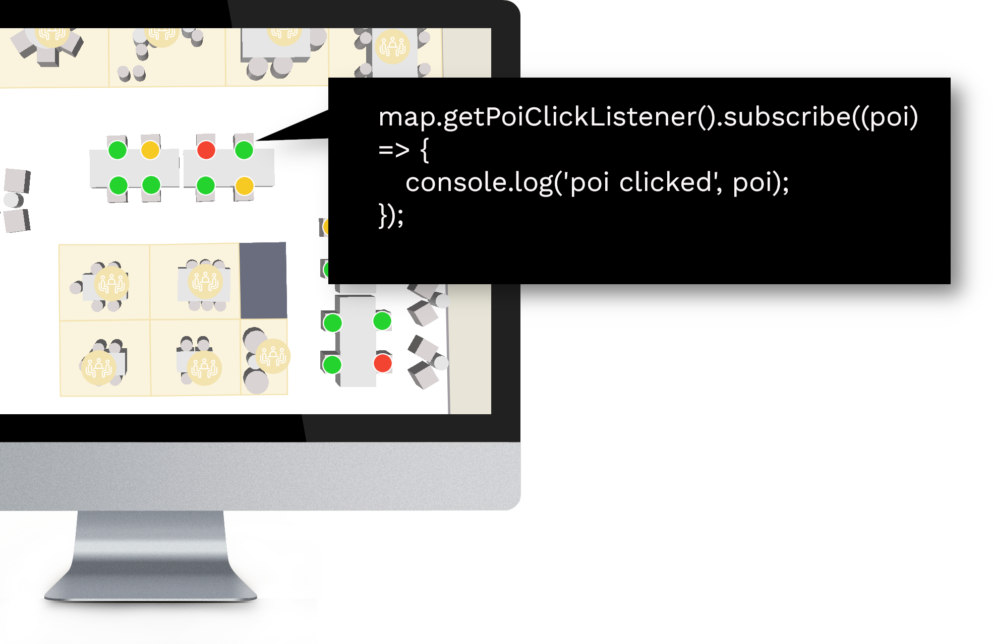
The wayfinding utilizes the Proximi.io JavaScript library, making it fully customizable to your needs. You can for example react to on-click events or display dynamic information.
For full integration into your website, online portal or digital product, we offer documented libraries and sample applications.
![]()
How is the wayfinding delivered?
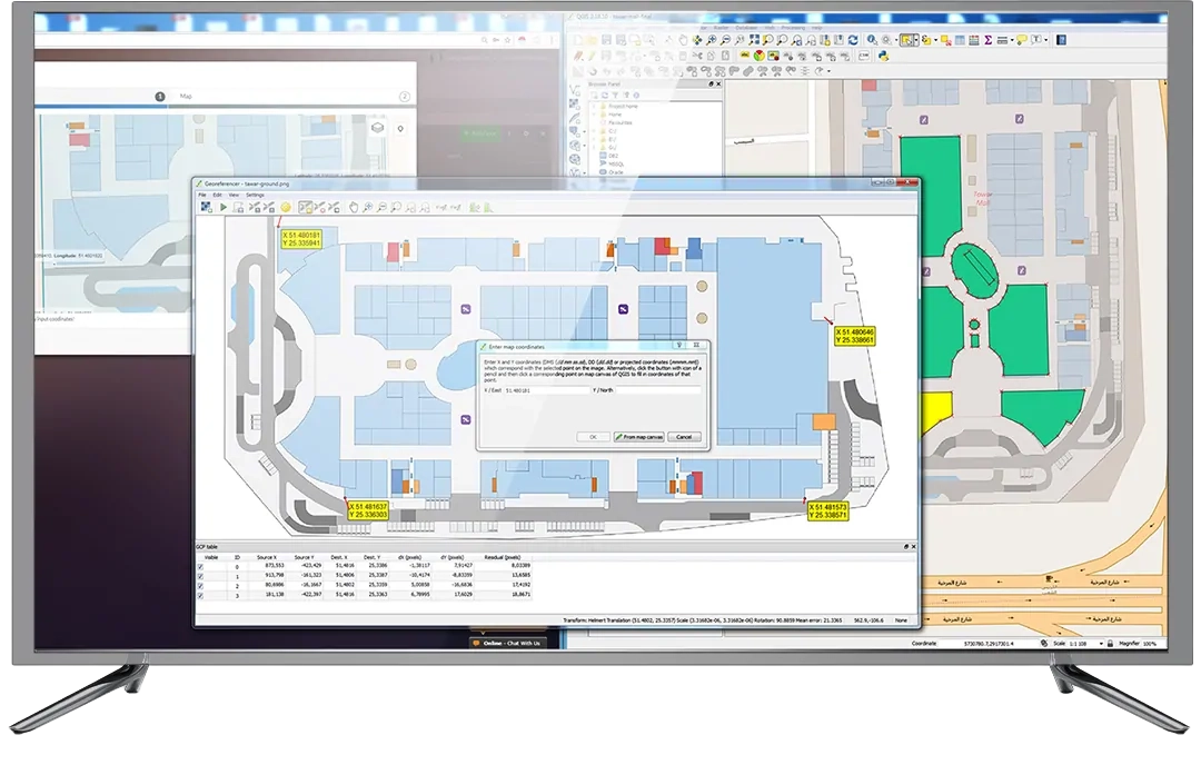
- Send us floorplans or maps of the venue
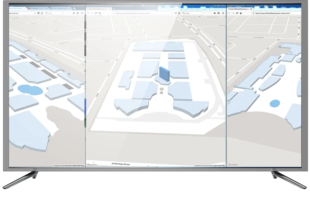
- We convert your venue floorplan to a sharp-looking vector format (GeoJSON) that scales nicely for different zoom levels. If your venue is an outdoor area, we can also convert your existing map images into map tiles, allowing for artistic visualizations.
- We onboard the venue on the Proximi.io portal, including adding of all the routes and Points of Interests
- Based on our libraries and sample project, you can integrate the map into your website or mobile application. OR, if preferred, we can tailor a turnkey wayfinding web app for you.
After delivery, you get access to the easy-to-use Proximi.io web portal. You can edit the wayfinding setup with the click-and-drag user interface. Changes done on the web portal are immediately synched to end user devices.