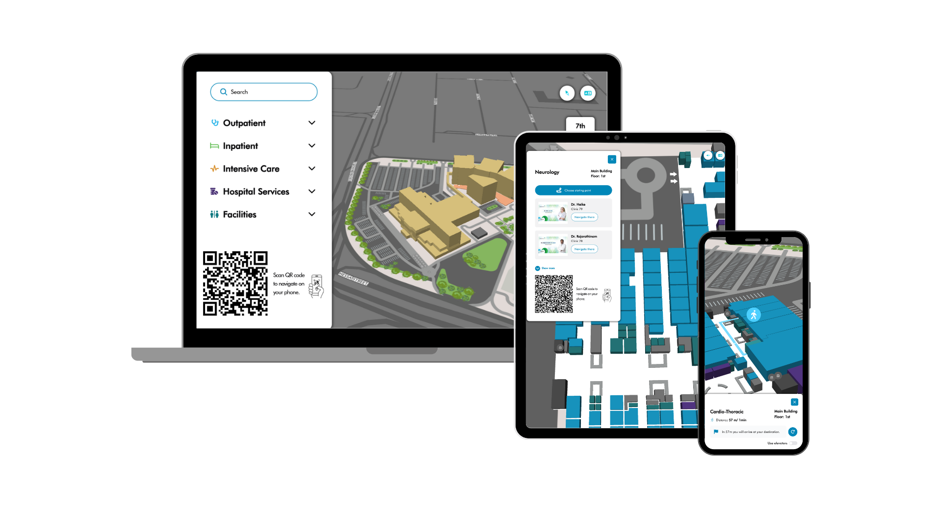
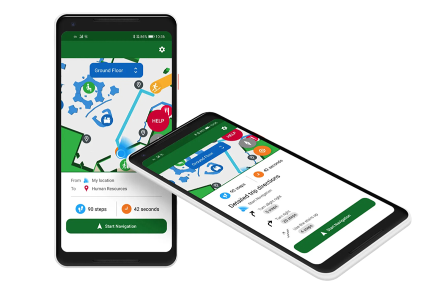
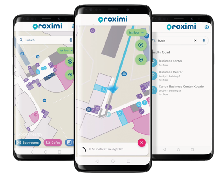
Generate interactive indoor maps

Start your navigation project by visualizing your indoor or outdoor venue with a sleek, scalable multi-floor floor plan. Add your Points of Interests with custom icons.  All changes you implement on the easy-to-use web portal are immediately updated to your app and visible for your users.

More on Proximi.io interactive maps
Interactive indoor maps of a mall, displayed on a mobile device and a computer screen
Installation of Bluetooth beacons for indoor positioning and indoor navigation

Connect to real-time indoor positioning

Connect the setup with Proximi.io proprietary indoor positioning library. The library works seamlessly indoors and outdoors, and across multiple floors. The technology combines Bluetooth beacon data with other sensor data and algorithms for determining the user’s current positioning.


More on indoor positioning

Accessible audio navigation

The navigation experience is tailored for both sighted and blind users. Proximi.io is the first platform to commercially implement the ITU-T F.921 protocol. That is a recommendation for “Audio-based indoor and outdoor network navigation system for persons with vision impairment”, released by the International Telecommunication Union. The recommendation specifies the format and details to be included in navigation instructions. Such as:

  • Audio notifications before instruction
  • Utilizing clock-face instructions instead of compass directions
  • Notifying user of landmarks that they are passing by on their journey
  • Alarming user of hazards on their journey
  • Arrival instructions
  • Possibility of determining different audio messages to different user groups
Accessible indoor navigation on two mobile phones
Indoor navigation with a Bleutooth beacon at a mall
3 mobile phones showing indoor map and indoor navigation

Readymade libraries for visualizing the navigation experience

Example applications for Android and iOS available with full navigation experience:

  • Floor selector for manual floor changes (floor changes automatically based on position data)
  • Category filtering
  • Search with autocomplete
  • Blue dot with compass direction
  • Path with progression visualization
  • Distance in meters and minutes
  • Written instructions, available in multiple languages. Can be translated into additional languages

Indoor navigation in action

References

Satasairaala Hospital

Female walking with mobile wayfinding application in hand, following blue lights.

KEKO Wayfinder

Tawar Mall