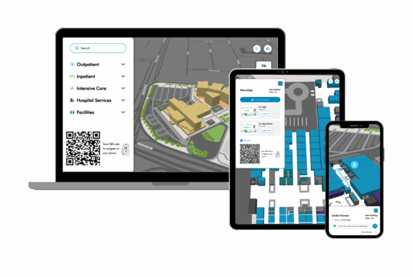
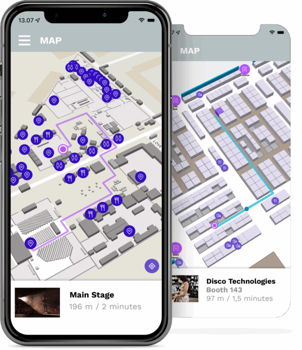
Visualize your venue with sharp, 3D or 2D styled floorplans. Proximi.io indoor maps are vector-based, which means that they scale smoothly when zoomed in or displayed on larger screens. Colours and icons can be tailored to your brand. The building is displayed on top of the city-wide map, allowing you to visualize multiple buildings on the same map (Open Street Maps).
Intelligent routing, adjustable on-the-go
Proximi.io routing algorithm calculates the ideal route from point A to point B. Routes can cover both indoor and outdoor areas, and connect multiple buildings to each other. Route setup and Points of Interests can be managed through the Management Portal with an easy click-and-drag tool in a manner of minutes. Changes are synched to end user devices in real-time.
Search with autocomplete
Category filtering
Multi-floor routing
Accessible routing options
Routing through open areas
Closest parking spot
Distance in meters and minutes
Uni-directional paths
Paths with opening times
Enable and disable parts of the setup
Partial offline support through caching
Real-time analytics
Works across all devices
Integrate the indoor maps to your website or mobile application or display on a wayfinding kiosk. Move between different screens through deep-linked QR codes. Use our readymade mobile-optimized map project as your base or integrate from scratch using our libraries. Read more on our documentation for Android, iOS and web.
Connect to real-time positioning
Proximi.io is based on GPS coordinates (WGDS-84), which allows you to utilize GPS positioning and indoor positioning with the interactive maps. PUtilize the following options for positioning data:
Websites:
- GPS positioning
- Indoor positioning through Apple Maps / Google Maps
- Location derived from a QR code
Mobile applications:
- GPS positioning
- Indoor positioning through Apple Maps / Google Maps
- Proximi.io indoor positioning